Virtual Surveyor Annually
From $1,500.00

Regular price
$1,500.00
Sale price
$1,500.00
Regular price
Unit price
per
Shipping calculated at checkout.
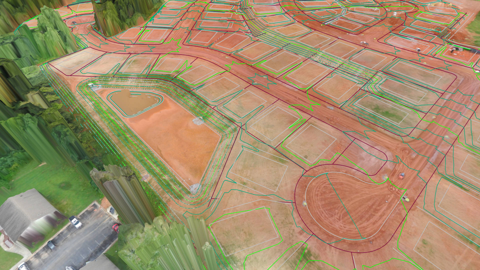
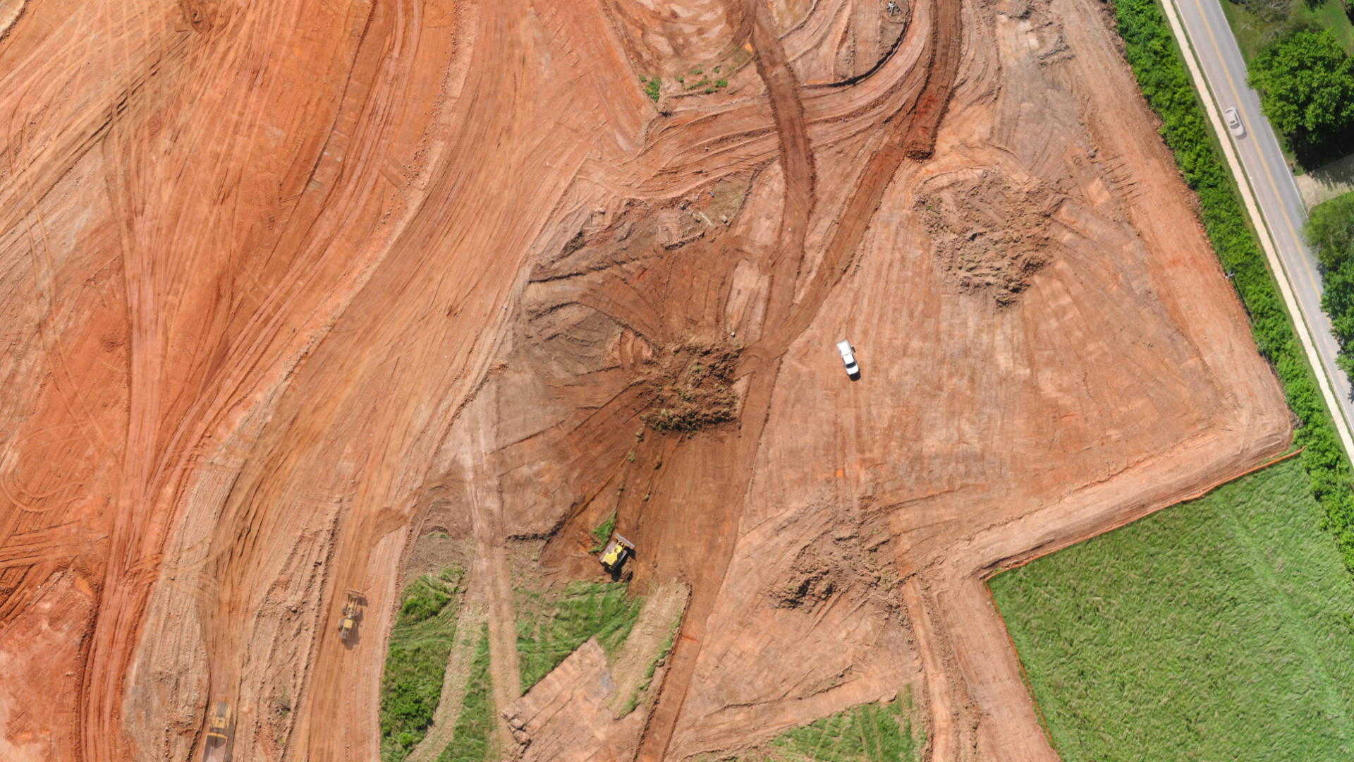
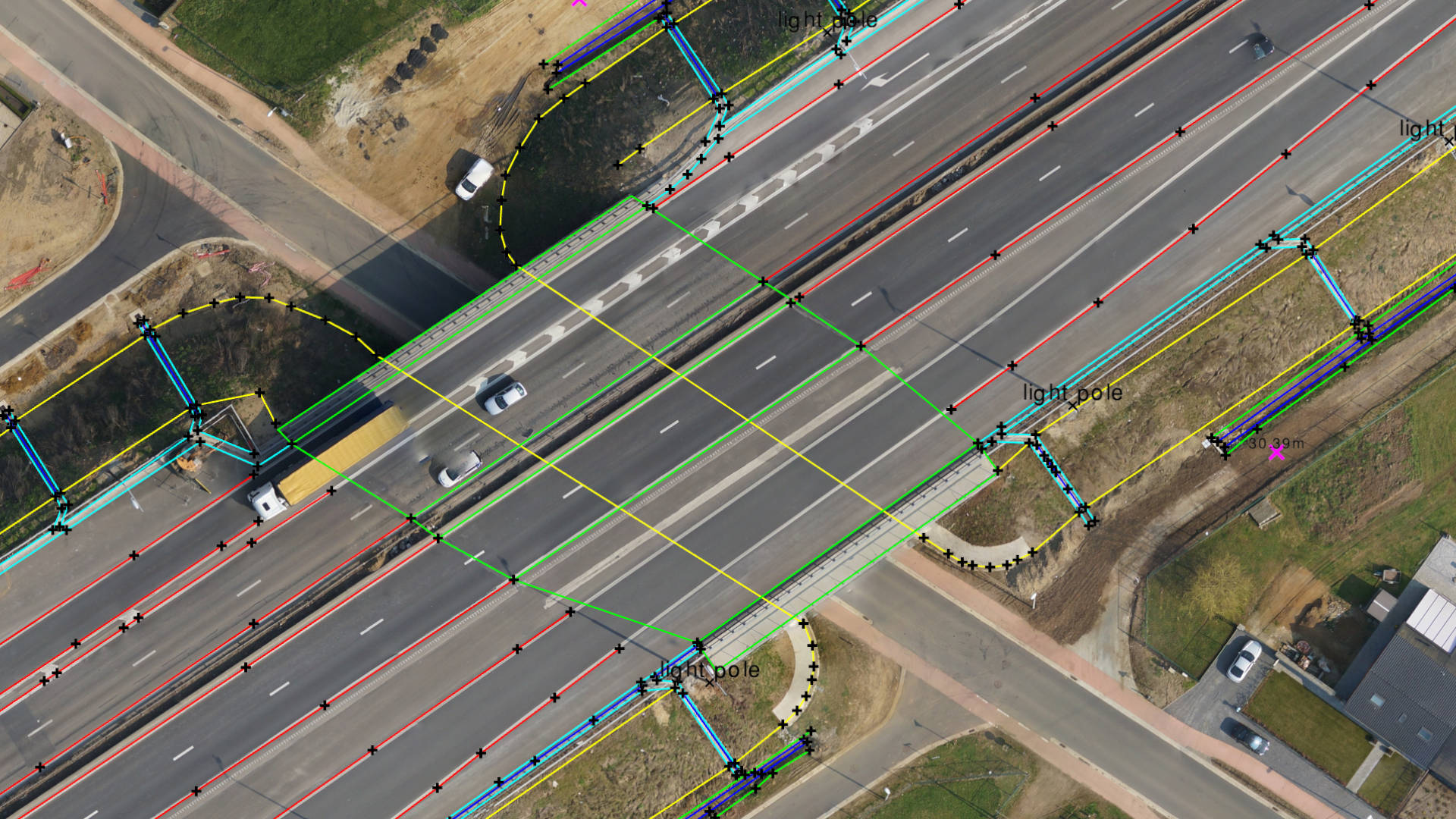
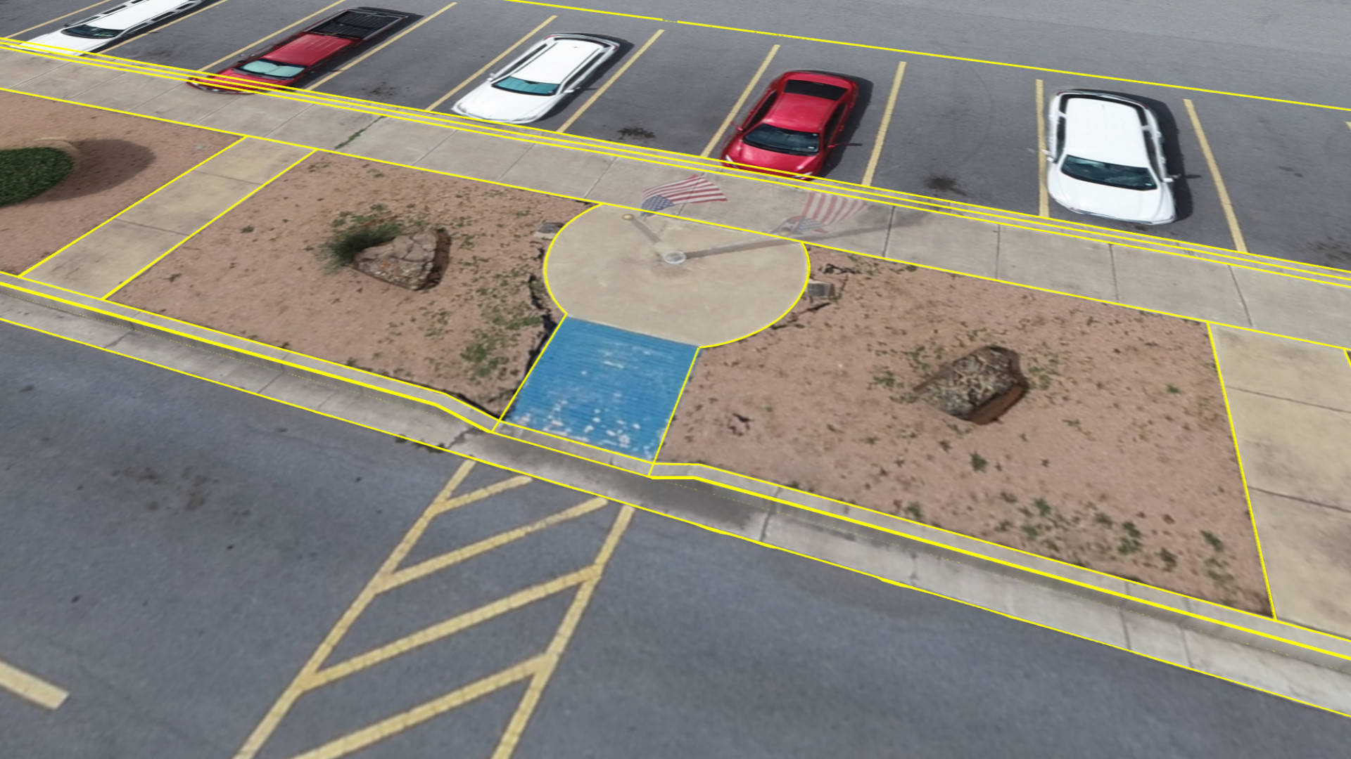
COMBINE DATA FROM DRONES, FIELD WORK, & CAD
Sometimes drone data is the only data source you need. Often, it is not. Add data from your field instruments (GPS or total station) to capture topographic features that cannot be observed from drones. Import civil designs from CAD and compare them with your drone data.
Support for data formats coming from civil design, field instruments, photogrammetry and airborne LiDAR:
- Orthophoto
- Digital Surface Model
- Point Clouds to DSM
- Point Clouds to Ortho
- Field Surveys
- DXF/LandXML files
LOOK AT YOUR DATA FROM ANY ANGLE
An interactive 3D view is ideal when you want to understand a topography and/or compare it with a design. A 2D map view is often easier when you are mapping linear features or need to prepare a report. The 2D profile view helps you to understand how your topography has changed over time. Switch instantly between these views.
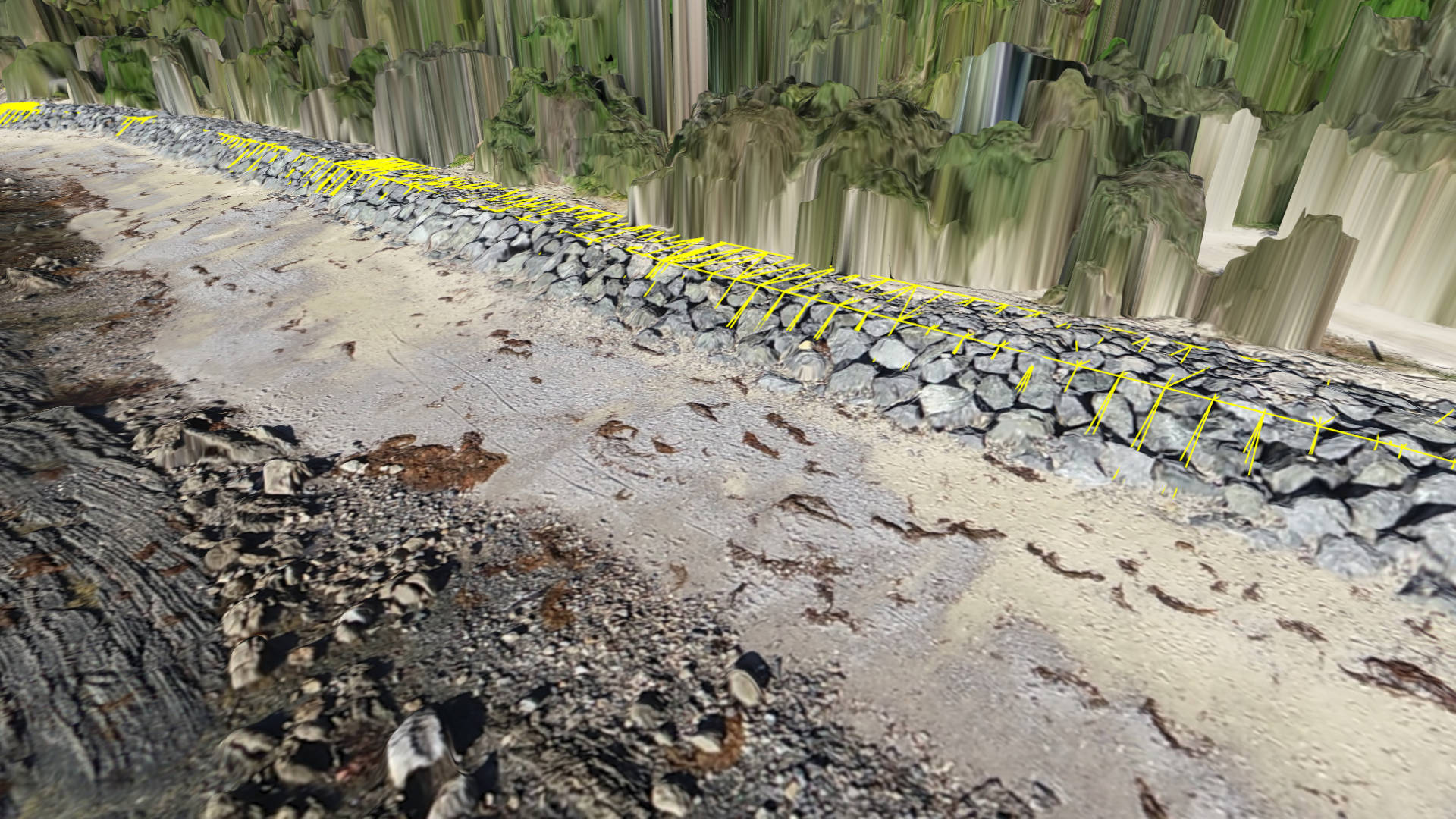
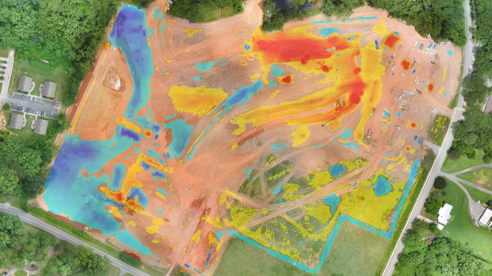
DIFFERENT SETS OF LENSES FOR BETTER INSIGHT
Often an orthophoto clearly displays the information you need to survey. Sometimes you want to look at the elevation only. Change the appearance of your drone data instantly through any of the 6 terrain lenses and visualize information that was hidden before.


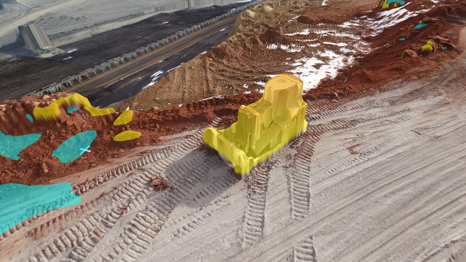
POINT TOOLS
- Draw Terrain Point
- Point Descriptos
- Set Point Elevations
- Point Annotations
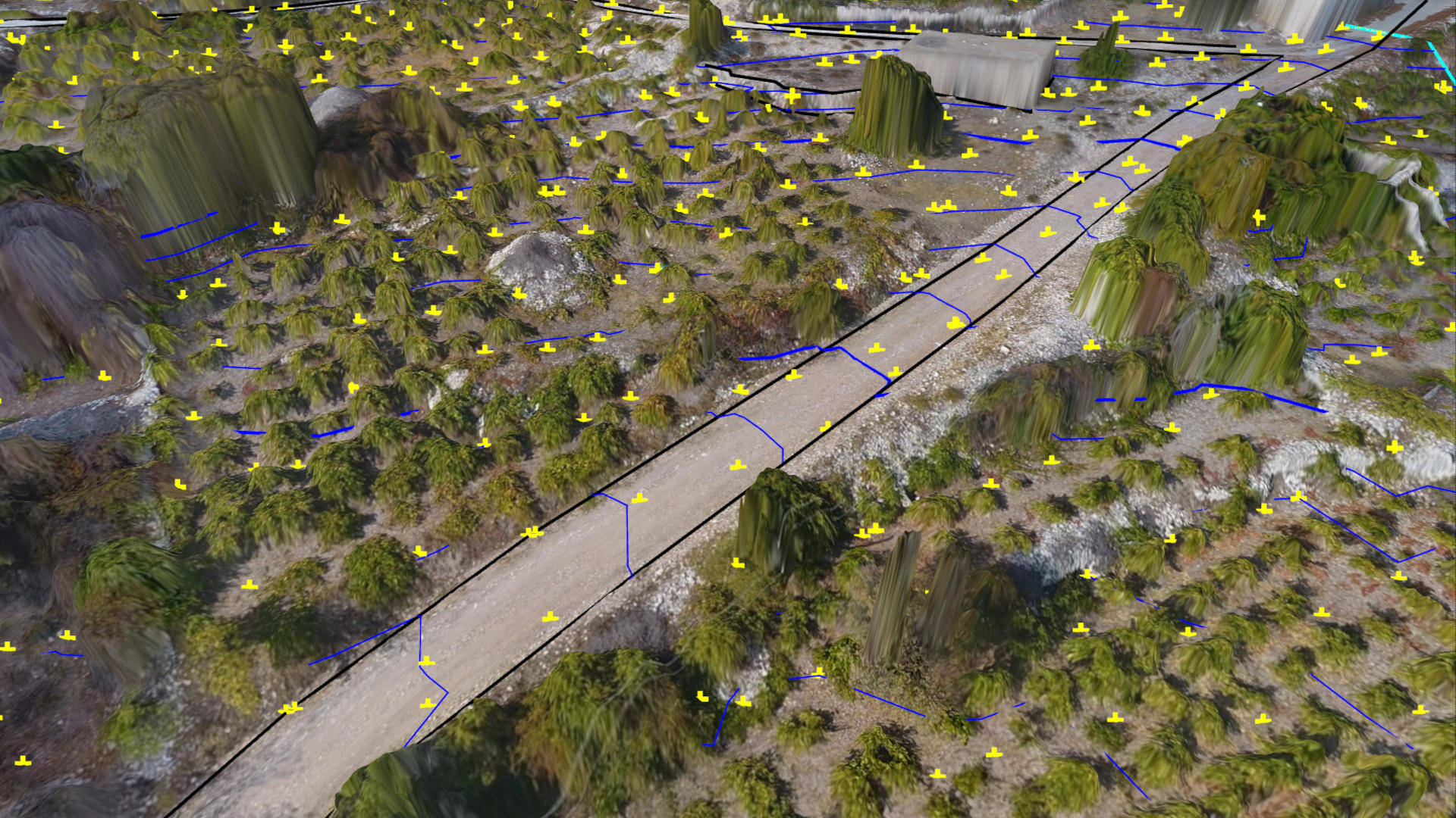
Create survey points at regular intervals. Or use intelligent algorithms to place points at bare-earth or topographic breaks. Erase tools provide an easy way to make quick edits.
- Regular point grid
- Low-pass grid
- Q-Point grid
- Remove grid points
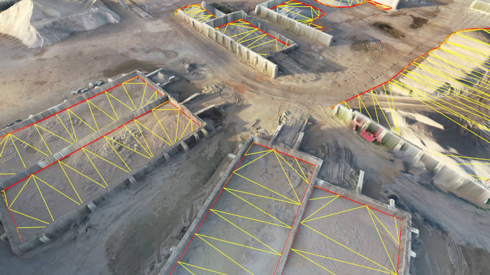
SURFACE TOOLS
- Quick surfaces
- Triagulate surveys
- Countour/TIN display
- Remove triangles
- Surface clipping
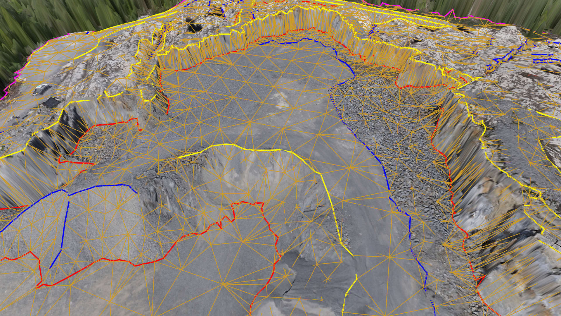
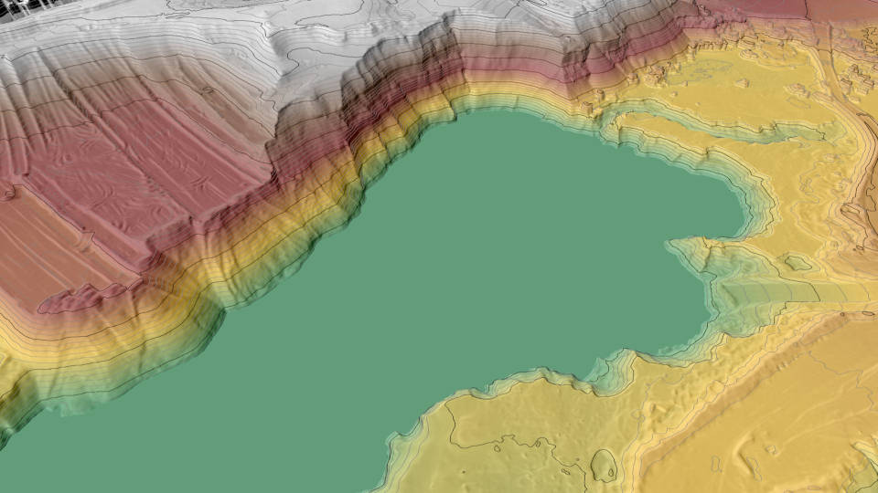
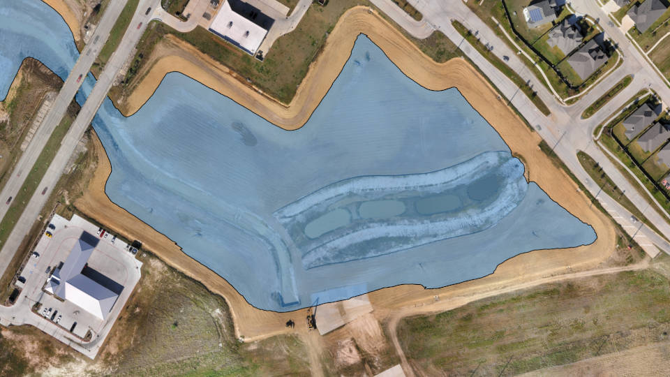
WATER
- Create water surface
- Set water leve
- Extract terrain intersection
- Calculate basin volume
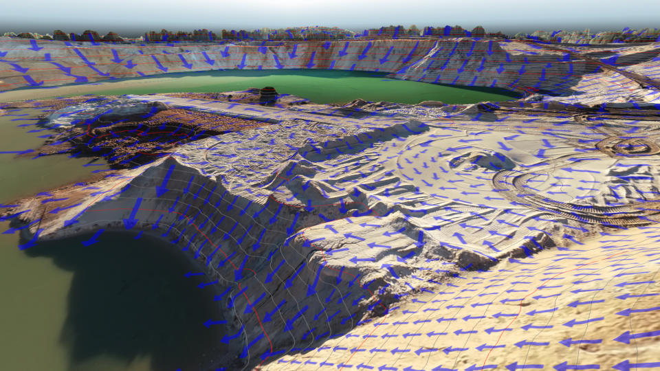
FLOW DIRECTIONS


