stitch3D Advanced - Annual
$900.00


Regular price
$900.00
Sale price
$900.00
Regular price
Unit price
per
Shipping calculated at checkout.
stitch3D Advanced Features:
- 150GB Storage
- Distance, height, area, and volume measurements
- Flythrough video creation
- Annotations
- 3D slice
- Base map access
- Unlimited file sharing & viewing
- Supported files: LAS, LAZ, E57, PLY
Workflow upgrades available:
- Point cloud classification
- Topo
- CRS Projection
View, Process, and Share Billions of Points with Ease.
Stitch3D helps teams manage and deliver LIDAR and photogrammetry point clouds on a secure and fully collaborative web platform.
Point Cloud Data Storage
Gone are the days of spending hours upon hours loading large point clouds to DropBox or Google Drive, only to be met with "file type unsupported" when a client attempts to view those files. With Stitch3D, you no longer have to worry about storing data on hard drives that can be easily misplaced or host LIDAR files on 3D incompatible data platforms. Finally - a data solution that actually works for 3D.
Secure 3D File Sharing
Everyone likes easy, and this is especially true when it comes to showing off your point clouds. Simply send your data over email or copy the quick link and post to your favorite social media sites. Control viewing and downloading permissions, turn off the public link at any time, and scale your storage whenever you have new projects. With instantaneous and secure access to 3D visualizations from anywhere and on any device, you'll never have to ship another hard drive again.
Interactive 3D Viewer
The real power of 3D is being able to communicate insights derived from the data visualization. Whether you're on-boarding a new client for the first time or communicating within a project, our innovative real-time multiplayer 3D viewer will let you markup, annotate, and add comments to your point clouds with up to 50 other users for a truly collaborative 3D experience.
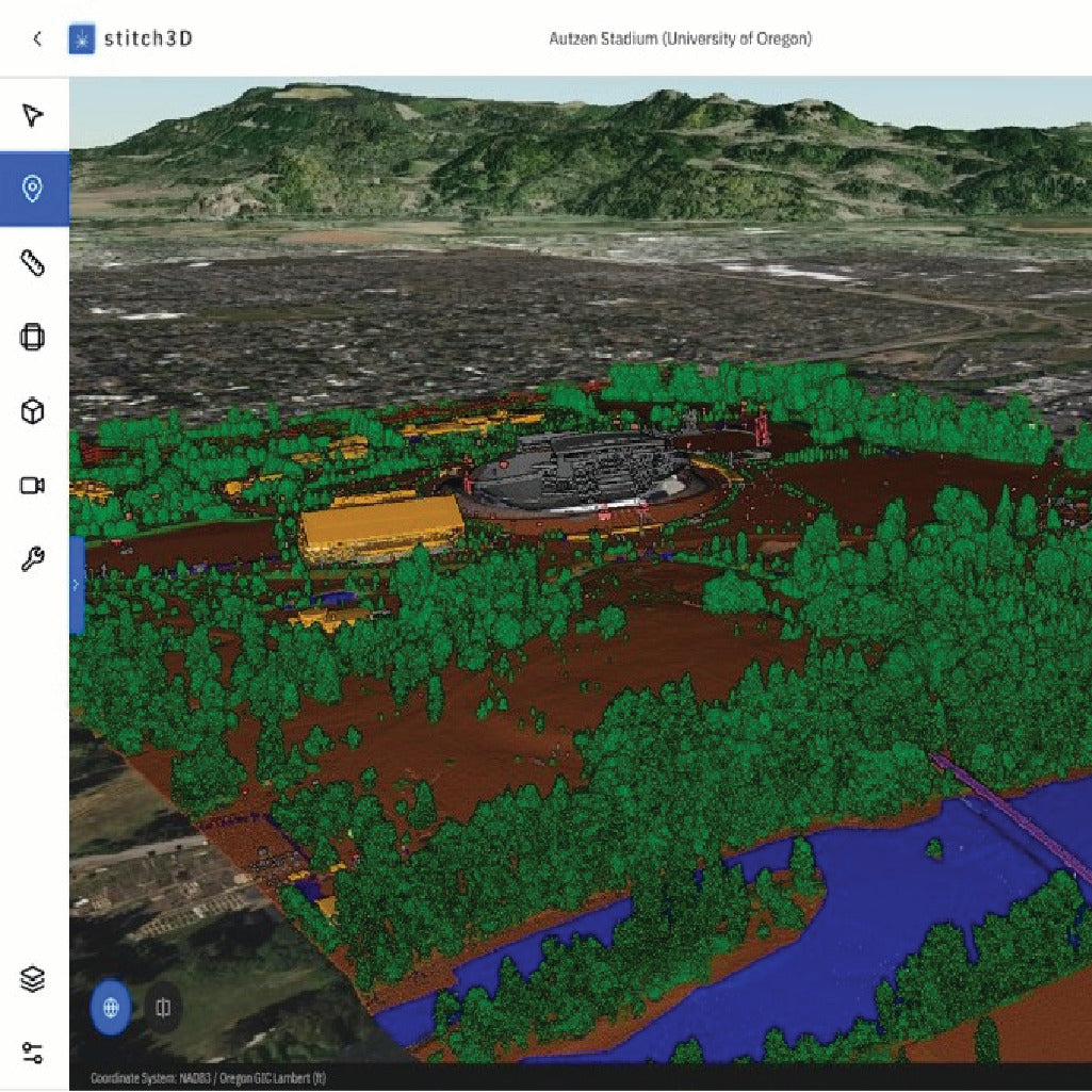
Georeferenced Mapping
Layer your georeferenced point cloud on a 3D satellite or street base map to give your data full context. Stitch3D automatically detects your point cloud's coordinate reference system (CRS) projection and aligns your data with accurate map coordinates.
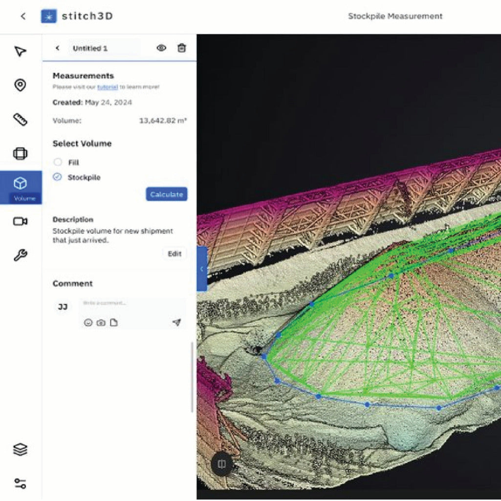
Stockpile Volumetrics
One of the most useful analytics you can pull from 3D data is volume information. With LIDAR, that analysis can be highly accurate. Whether you're tracking the tonnage of material excavated from a mine or the amount of cargo loaded onto a bulk carrier container ship, a quick LIDAR scan and Stitch3D's volume tool can let you accurately forecast material revenue (or cost).