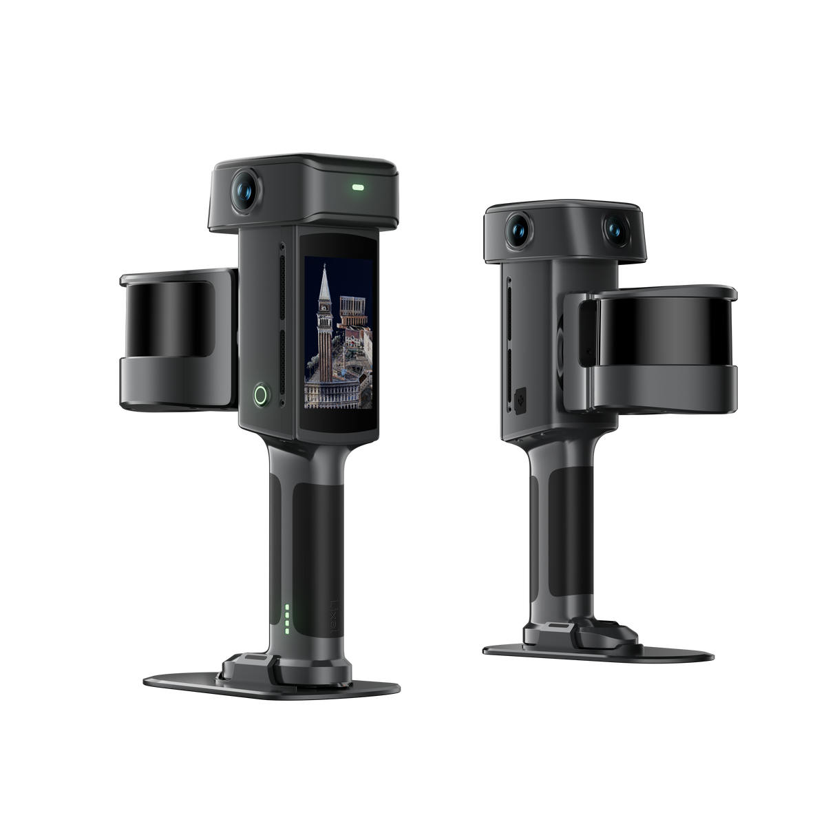
XGRIDS Lixel L3


What's New with L3
Lixel L3 is XGRIDS' flagship high-accuracy spatial scanner, built around a validated 5 mm relative accuracy figure. It combines a high-accuracy LiDAR, a 4K HDR true-color camera system, an integrated RTK module, and an on-device display in a single mobile scanner. One capture produces a high-accuracy point cloud, a mesh, and a photorealistic 3D Gaussian Splatting (3DGS) scene; data that integrates directly into professional workflows across architecture, digital twin, film production, and cultural heritage and tourism.
%3C/h3%3E%3Ctable%20width=)
Key Specifications (vs. L2 Pro)
| Category | Specification | Lixel L3 | Lixel L2 Pro |
| Basic Information | LiDAR configuration |
|
|
| Hardware configuration |
|
— | |
| Camera | CMOS sensor size | 1/1.3 in | 1/2 in |
| Native resolution | 3 × 50 MP | 2 × 48 MP | |
| Output resolution | 4096 × 3072 | 4000 × 3000 | |
| HDR | 4K HDR supported | Not supported | |
| Forward-facing camera | RGB camera | Depth camera | |
| Forward-facing camera field of view | 100° × 85° | 190° × 119° | |
| Accuracy | Relative accuracy | 5 mm In a dedicated 500 m² test environment |
1 cm |
| Absolute accuracy | 2 cm | 3 cm | |
| Point cloud thickness | 5 mm | 5 mm | |
| Levelness (with RTK fusion) | 0.005° | 0.015° | |
| Levelness (without RTK fusion) | 0.02° | 0.03° | |
| Data processing | On-device real-time algorithms |
|
— |
| Design & physical | Weight | 2.5 kg incl. battery | Approx. 3 kg incl. battery, surveying RTK module, and phone |
| Ergonomics / support rig | Shoulder strap, torso brace, and telescoping arm; carries the device weight, leaving the operator to steady it | — | |
| Control point collection | Control point tip at the base of the handle; aim the tip at the point and trigger from the screen or the power button; wall control points can be measured without tilting the device; compatible with a survey pole | — | |
| Outputs | True-color point cloud | Improved image quality gives the point cloud better color and detail, holding both highlights and shadow detail; supports local enhancement (upsampling) of priority objects | — |
| LCC | Improved image quality strengthens the LCC result, with richer color and tonal range across both bright and dark areas | — | |
| Mesh | Improved image quality gives the mesh finer structure and texture | — | |
| Environment handling | Low-feature environment optimization | Optimized for tunnels and other low-feature environments | — |
| Compatibility | RTK survey pole | Compatible with standard RTK survey poles; no proprietary extension pole | — |
Why Choose the Lixel L3
5 mm Accuracy, Documented
- 5 mm post-processed relative accuracy
- 2 cm absolute accuracy (2.5 cm real-time)
- 0.005° levelness with RTK fusion
Tested in a dedicated 500 m² environment, with all figures stated at 1 sigma. An official Accuracy Validation White Paper will be available at launch, so partners can explain exactly where the 5 mm figure applies.
Imaging-Grade True-Color Vision
A 1/1.3" sensor, 3×50 MP camera array, and 4K HDR imaging produce a structurally accurate point cloud with natural color, material, and shadow detail, making objects easier to identify and results easier to explain to customers. Key objects (railings, pipework, nameplates) can be enhanced locally without slowing down the whole dataset.
Usable Results Straight Out of the Field
Integrated RTK, real-time loop closure, levelness optimization, and AI filtering work together during capture to:
- Reduce drift and layering over large areas
- Stay stable in low-feature or repetitive environments
- Remove moving people, vehicles, and noise
- Convert WGS 84 / CGCS2000 coordinates in real time
The real-time point cloud is a usable deliverable, not just a coverage preview.
One Scan, Three Spatial Outputs
- True-color point cloud: geometry and color for measurement, CAD, BIM, and engineering
- Mesh: textured surfaces and structural lines for modeling and visualization
- 3D Gaussian Splatting (3DGS): photorealistic scenes for digital twins, location scouting, and simulation
One visit, one dataset, multiple deliverables.
Smoother Field Operation
A 4.3", 1000-nit display shows point cloud, trajectory, and coverage with no phone required. The support rig carries the device weight, and a handle-mounted control point tip plus direct survey-pole connection simplify control-point collection and elevated capture.
Flexible Processing
Multiple scan segments merge automatically through region-selection matching, with no control points needed. Automatic face and license-plate blurring handles privacy for public-space data without manual masking.
Open Data for Existing Workflows
LixelStudio and LCC expose Creator Data (perspective images, COLMAP datasets, 3DGS intermediates), plus SDKs/plugins for custom integration. Point clouds support Scan-to-BIM in Revit; 3DGS connects to Unreal Engine and NVIDIA Isaac Sim for scouting, previsualization, and simulation.